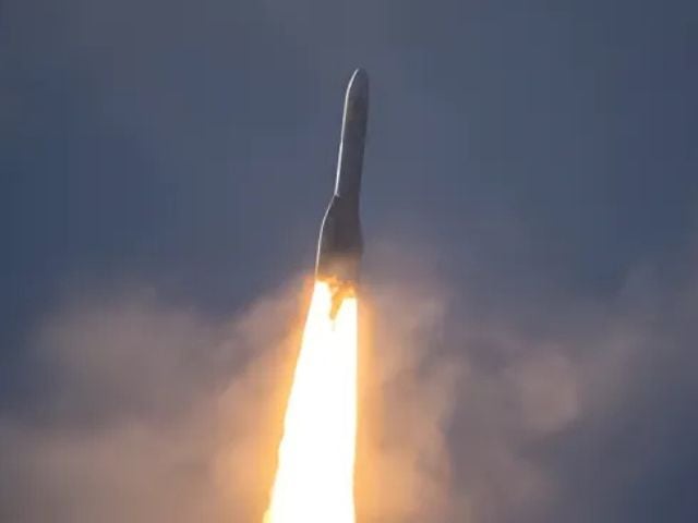
A new satellite set to launch on Tuesday will allow scientists to measure the carbon stored in the world’s forests with unprecedented accuracy, marking a breakthrough in the global effort to monitor and tackle climate change.
The European Space Agency’s Biomass satellite, the first of its kind, is designed to peer through clouds and dense forest canopies to “weigh” trees across the planet. It will help determine how much planet-warming carbon is locked in trunks and branches—information that has long remained elusive.
Scheduled to lift off from ESA’s Kourou base in French Guiana at 10:15 BST, the 1.2-tonne satellite is equipped with a 12-metre radar antenna, earning it the nickname “space brolly”.
Although recent studies highlight the significant amount of carbon stored by the planet’s 1.5 trillion trees in rainforests.
Developed by European aerospace firm Airbus, the radar uses an unusually long wavelength to penetrate layers of forest that traditional satellites cannot see.
“Most radars only capture the forest canopy, the small twigs and leaves,” said Dr Ralph Cordey, head of geosciences at Airbus. “But with a longer radar wavelength, we can look deeper into the forest and observe branches and trunks.”
The satellite will conduct multiple passes over rainforests and use a CT scan-like method to analyse “slices” of forest, creating a layered view of the woody biomass. This material acts as a key proxy for estimating how much carbon dioxide is being stored and kept out of the atmosphere.
Previously, researchers have attempted to measure carbon by analysing individual trees and extrapolating the data across entire ecosystems—a process Professor Mat Disney of University College London called “a huge challenge.”
“Our current understanding is really patchy,” Disney said. “You’re trying to weigh carbon stored in one and a half trillion trees. Satellites are really the only way to do that consistently.”
Verification efforts on the ground will continue to ensure the satellite’s measurements match real-world data. Scientists say the information could be critical in modelling climate projections and tracking deforestation trends.
After two decades of preparation, the European Space Agency’s Biomass satellite is ready to launch—but the mission isn’t without its challenges.
The satellite features a giant 12-metre deployable radar antenna that will unfurl like a massive umbrella in orbit. That mechanism must function flawlessly.
“There are some major components, including the large antenna, which must deploy smoothly in space,” said Dr Ralph Cordey, head of geosciences at Airbus.
To build the complex reflector, Airbus enlisted engineers from L3Harris Technologies, a US firm with expertise in large foldable satellite systems. This know-how isn’t yet available within Europe.
If deployment is successful, the mission is expected to deliver its first forest carbon maps within six months. The satellite will then operate for five years, collecting global data.
The Biomass mission aims to provide the first accurate measurements of how much carbon is held in trees—and how much is lost through deforestation.
Unlike other satellites, Biomass uses a longer radar wavelength, allowing it to see through cloud cover and dense forest canopies.
“Conventional systems, like Landsat, struggle in tropical regions due to near-constant cloud cover,” said Professor Mat Disney, a remote sensing expert at University College London.
“This technology will finally give us a consistent view of forests over time,” he added.
Researchers say this capability is critical for understanding the carbon cycle and the role of forests in mitigating climate change.
“It’s fascinating because it helps us understand a vital, often overlooked part of the Earth system,” said Dr Cordey. “Our forests play a huge role in how the planet works—and that has never been more important to study than now.”


